Mostly I am a still photographer but may be learning a new avenue.
I’m starting to explore the video capability of my (small) DJI Mini SE drone. This was done from our back yard just after sunrise this week – no sound/music, titles or anything – just the raw video that eventually pans from Fenwick Island to Ocean City.
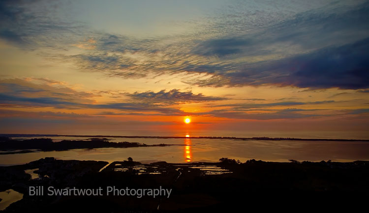
Here’s one of my still photographs of a sunrise captured from the exact same location…
Sunrise over Little Assawoman Bay behind Fenwick Island, Delaware
Of course, the jury is still out…about video and me…or me and video.
I can now fly a “drone” for commercial purposes to expand my photography reach and perspective.
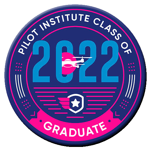
Pilot Institute Class of 2022 Remote Pilot Graduate
The Part 107 Certificate, as it is called, provides me with an FAA (Federal Aviation Administration) license as a Remote Pilot with the rating of Small Unmanned Aircraft Systems. This allows me to fly my “drone(s)” for commercial purposes. I can now capture photographs of my (our) favorite places – from a new perspective – and offer them for sale in my online galleries. The “commercial” designation deals with the actual intent of the flight – so I did not heretofore shoot any photographs with the intent of offering them as wall art. But Now I Will Begin…
I studied an online course provided by the Pilot Institute and, because of that preparation, was well-prepared to pass the FAA written exam and obtain my Part 107 Certificate. So you might say I am a successful graduate of the Pilot Institute Class of 2022. Seriously, it is a good program and I will write a review in a future article. BTW, I managed to score a 92% on the test. I’ll take it. And make use of it.
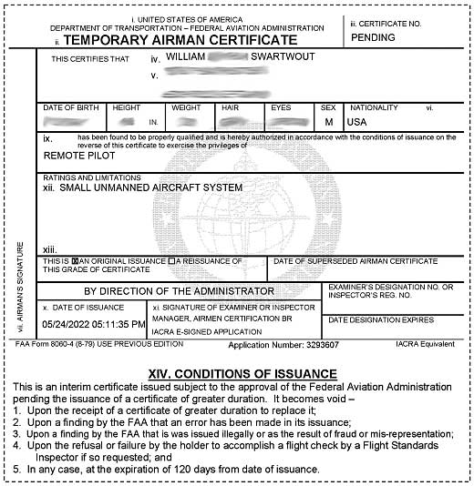
Remote Pilot Temporary Airman Certificate – the certificate is “temporary” until it is replaced by the actual (plastic) license itself. It will be similar in appearance to my Private Pilot license – but serves a different purpose.
It is permissible to fly a drone without a Part 107 license – for recreational purposes only. Those pilots/flyers must complete a training program and earn a TRUST Certificate. “The Recreational UAS Safety Test” is a free program and is offered through several sources. I did my TRUST training through the Pilot Institute’s TRUST Portal when I first got my drone.
However, please be aware that there are many unlicensed drone flyers out there performing commercial operations – doing things like real estate photography, inspection work, etc. – without a license. They are operating in the national airspace system without being properly trained and are, therefore, a safety hazard to others. The federal government has been monitoring, catching and (severely) fining perpetrators. Fines are even being levied against people (for example, real estate agents) who hire unlicensed drone operators.
I managed to fly, perform basic maneuvers and land with no problems.
Enough snow melted so I could find some grassy areas and the wind died down – so I figured it was time to overcome my nerves and fly this thing. A long, long time ago I flew Radio Control airplanes and helicopters – and remember a lot of happenings (crashes?). This drone is much easier to control than what I remembered from the past. Much easier!
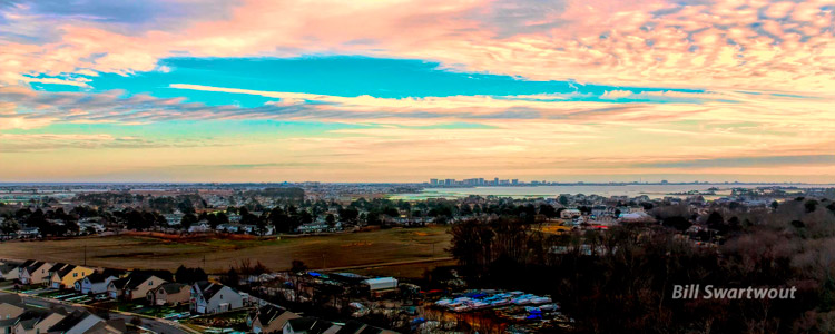
So, here is my first photograph (that looks like anything other than a test shot). I was 50 meters ( 165 feet) above our back yard and facing southeast toward Ocean City, Maryland. The high-rise buildings of Condo Row (just right of center) are about five miles away.
The water in the foreground of the Ocean City Skyline is Assawoman Bay and the water on the horizon is the Atlantic Ocean. This look quite impressive as a semi-panorama 4,000 pixels wide by 1,600 high.
I did not want to put the drone on the grass for launch so I made a makeshift takeoff/landing pad from a piece of heavy cardboard reinforced with Styrofoam strips. I may waterproof and paint the cardboard to make a more permanent landing pad. Of course, if I paint an “H” in the center it may become my Heliport.
I first tried a short flight in a sheltered area on one side of our home. I did the “Auto takeoff” and hovered a bit right in front of me to check the drone over. I didn’t see anything out of the ordinary so I explored the controls. I went up and down a little and yawed left and right with the left stick. As I gained a bit of confidence I tried the right stick and propelled the aircraft forward, backward and to the each side. Next I took a short flight out and back and then proceeded to “Auto land” my new airship.
For a second flight I moved to the back yard where I had more “space” and figured I would expand my reach, so to speak, a bit higher and further. I hovered in place to make sure the drone could handle the slight breeze. It did, so I ascended to 50 meters (165 feet) and yawed in a circle a couple of times – all the while changing my gaze from the screen to the drone. I was impressed with what I could see and took a few pictures. The most interesting one, in the fading light, was the one posted above – the skyline of Ocean City, Maryland.
The batteries are charging now, as I type this, for my next adventure into the sky. So, of course, there is more snow in the forecast for tomorrow morning and I can hear the wind howling right now. I may have to practice continued patience – but I do not want to “push” anything until I am well experienced.